Last updated 25 October 2020
The Magic of Skye
Part Two
The Isle of Skye on Scotland’s west coast offers a delectable assortment for the outdoor enthusiast. I recommend deviating from the popular routes and uncovering a few of Skye’s lesser-known gems in the more remote regions.
Thanks to isolation and no travel during the Coronavirus pandemic, I’ve finally found the time to finish writing about the daily hikes on my Wilderness Scotland tour around Skye (only two years after the hike!)
Writing about each day’s hikes, the post became rather long, so I split it into two parts.
This is part two covering days four to seven. The first post – covering days one to three is here
At the time of publishing, during these unprecedented times, international travel is placed on hold. But there is time for reading and looking at photos. Time for inspiration, dreaming and planning. We will not be staying home forever! And it is my personal belief that connecting with nature and wild open spaces will become more of a driver in determining future holidays.
Slower travel, responsible travel. Skye more than adequately fits that criteria.
From the dark jagged hill of the Cuillin to the softer shores of the south, Skye’s challenging landscape is richly varied. There’s diversity too in its climate which embraces the soft beauty of a summer’s day and the wild power of a winter storm at sea.
Quote from the box of three TALISKER whisky’s I purchased on Skye. Yes, you read that correctly. Jen has acquired a taste for whisky. My father would be happy to know that finally, I have seen the light 🙂
I’m starting this post where I left off – wondering if Skye could top the rugged and mystical scenery of the Quiraing?
Day four – exploring the southern edge of Loch Coruisk and the Cuillin mountains
The island’s name comes from an old Norse word sky-a, meaning ‘cloud island.’ The Viking reference is to the often-mist-covered Cuillin Hills. The alpine-like jagged ridges of the Cuillins (Black and Red) provide the keen hiker with some of Skye’s most challenging mountain terrain. The twin topped Sgurr Alasdair (992 metres) is the highest peak on the northern half of the Black Cuillin ridge and the highest on the Isle of Skye.
“One of the longest rock climbs in Britain,” Jude explains.
It was the Cuillins her father took her to for her first hiking experience when she was twelve. She nominates the Cuillins as her favourite hiking destination in Scotland.
“For the challenge and the memories.”
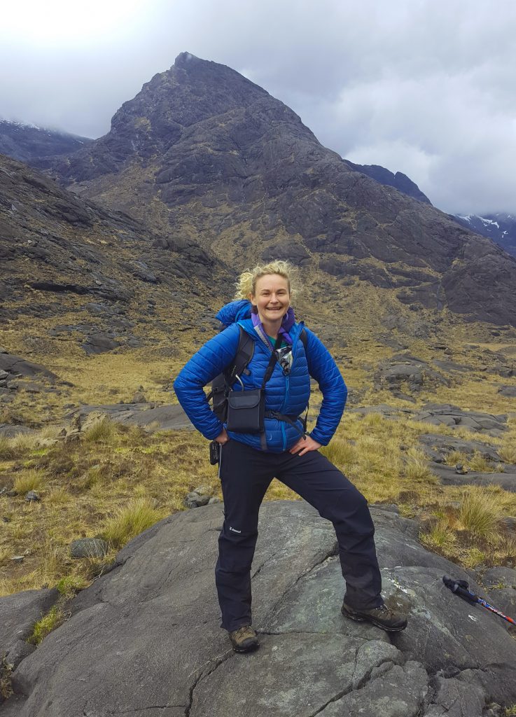
Tour guide Judith Work at the Cuillins
Our hiking group is not in the adventurous category to attempt to climb the spectacular mountain ridges. We happily settle for an exploration around the base.

Hiking the Cuillin on the Isle of Skye
Jude drives to the harbour at Elgol, a sparsely populated crofting and fishing village on the shores of Loch Scavaig, on the Strathaird peninsula where We board a boat called the Bella Jane
Circumnavigating Loch na Cuilce, Skipper Pete provides an enthusiastic description of the history of the area (although I struggle at times to understand his thick Scottish brogue.) We pull into a small jetty on the southern edge of the Cuillin mountains. Nearby, on a rocky outcrop, a few seals warm their blubbery bodies, ignoring our boat and disembarking passengers.
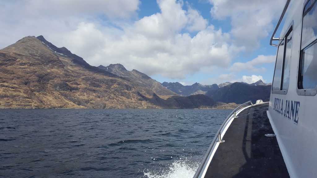
The Bella Jane approaches the Cuillins
Helmsman Norman and Skipper Pete have discussed the impending weather. They recommend an earlier than usual pick-up time of 2 pm giving us only a few hours to scramble around the shoreline of freshwater Loch Coruisk.
“Unfortunately, this is one of the poorer days and if we leave much later, the water past the island will become too rough and choppy,” explains Norman. “Might upset some of the passengers.”

Marg, Pete and Norman on the Bella Jane
We make the most of the time we have to explore beyond the lochs, rock-hopping like mountain goats across the rugged landscape. Finding a flat rock to sit and devour our packed lunch, I admire those distant ridges many adventurers have climbed.
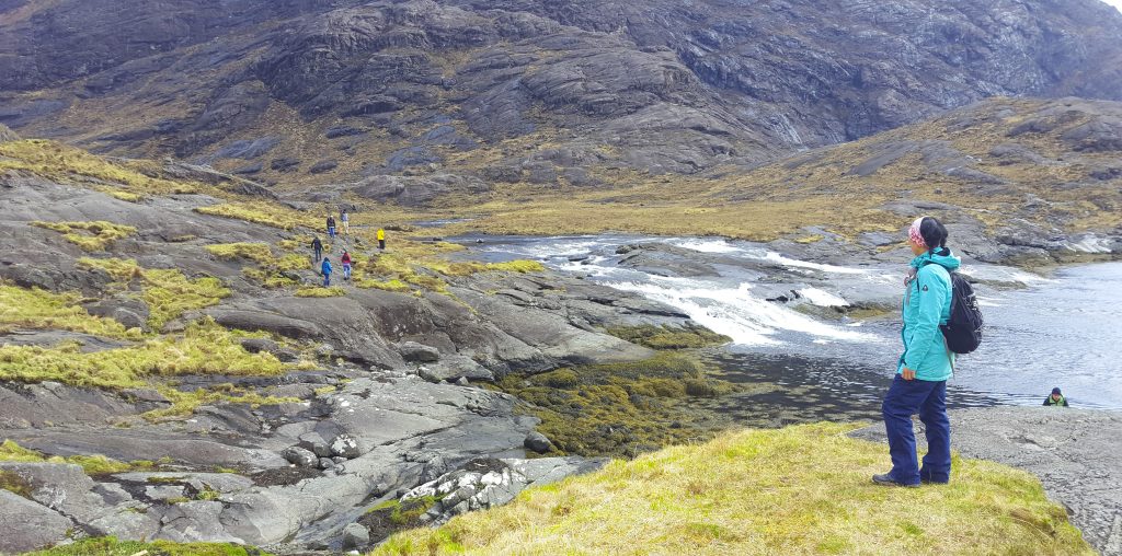
Exploring the base of the Cuillins
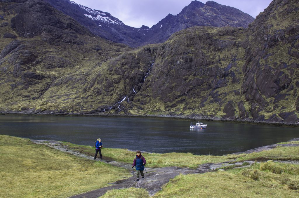
Loch na Cuilice hiking at the base of the Cuillins
From the shore at Elgol, we make our way to our new accommodation, the Hotel Eilean Iarmain in Isleornsay, another breathtaking location with views across the water to the Knoydart Peninsula. That night our group enjoys dinner at the hotel’s onsite restaurant. Hearty pub-grub, friendly staff, and more local whisky make a winning combination. Our room is only a short stumble of 20 meters or so. We sleep soundly.
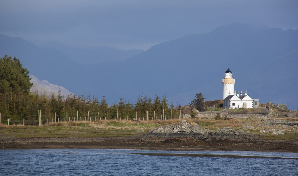
Isleornsay Lighthouse on Ornsay Island Isle of Skye
Summary of hike: Loch Coruisk
The path can be boggy in places and would not be easy to follow without a guide. It requires some rock jumping across streams. The crossing of the river at the foot of the loch could be a challenge (and may not be possible) after heavy rains.
Walk details: 5 km approximately 3 hours
Day five – Isle of Raasay
Today we explore Raasay Island, off Skye’s east coast. This rugged 23-kilometre stretch of land (from north to south) is roughly the size of Manhattan, but with only 161 residents, that’s where the comparison ends. Raasay is only accessible by boat. We board the CalMac ferry at Sconser arriving on the southern end of the Island (a 25-minute ferry ride) to the ferry terminus at Churchton Bay. Driving north through Oskraig to Brochel, we pass a peninsula where Brochel Castle once stood. Despite the crumbling ruins we see today, I imagine in its former glory, Brochel Castle would have been a formidable sight from the water.
Our destination is the small settlement of Arnish, only 14 kilometres from the ferry terminal. The single road is rough in places taking 45 minutes to reach the Torran Circuit. The walk is at the end of Calum’s Road. A road made by Calum (Malcom) MacLeod. This resilient Scot singlehandedly built the 1.76-kilometre section of road from Brochel to his home in the remote outpost Arnish. From the mid-1960s, for 10 years Calum toiled with his rudimentary tools: a pick, shovel and wheelbarrow. A mighty effort considering he also worked his day job as a crofter, light housekeeper, and postman.
Why build your own road?
To make the journey easier for his only child, – daughter Julia – to come and visit him from Skye. (A thoughtful father there!)
Calum also had a hand building the coastal footpath from Torran to Flodda. He and his brother Charles built the trail between 1949 and 1952.
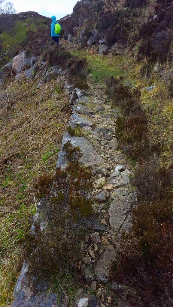
Torran Circuit Walk Path
On either side of the path, the jagged rock formations are streaked with layers of pink. These ‘Lewisian Gneiss’ rocks (from the Isle of Lewis) are unique to Skye. They were laid down in ancient river systems 1,000 million years ago.
At a sheltered section overlooking the almond-shaped tidal island of Fladda (2.5 kilometres in length and 1 kilometre wide) we stop for lunch, trying to avoid the wind and ignore the light rain. The tide is low and I watch Dave in his mustard-coloured raincoat stride over the rocks and seaweed-strewn causeway to reach the small island. The causeway is accessible only during low tide. The handful of houses on the island are now guest houses – the tide dependant access most likely is a deterrent for permanent settlers.
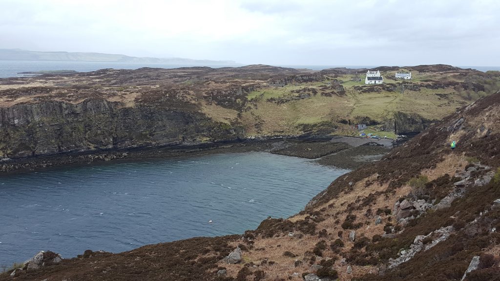
Tidal Island of Fladda on the Torran Circuit Isle of Raasay
The walk continues in a circuit but with the weather closing in, we backtrack the same path to the car park, reaching the van the moment the skies open. Back on Skye, in the village of Carbost Jude keeps her promise. Sue asked about visiting the famous Talisker distillery after spying it on the way to Raasay. A few tasting nips warms the insides. Purchases are made, including moi, who so taken by the taste, made my first ever purchase of a single malt whisky. (Three x 50ml travel size bottles – conscious of my bag weight!)
No whisky has a greater sense of place than TALISKER: since 1830 it has been the only single malt made by the sea on the forbidding Isle of Skye.
Summary of walk: Torran Circuit
Clear paths, steep in places. One short boggy section.
Walk details: Variable – up to 10km, approx. 5hrs
Day six – The Clearance Villages of Boreaig and Suisnish – the Cleared Coast
While the Highlands have always been wild and underpopulated, many remote glens and bays coveted small residential populations. But sadly, the Highland Clearances of the 18th Century, hastened the demise of many of these small communities.
“The Clearances began after Culloden (1745) and went on to the mid-1800s,” Jude explains. “The Ruling English had little respect for the Scots, they wanted the land to run sheep.”
Profit spoke louder than the welfare of those who’d toiled the land for centuries. Landlords prevented owners from returning to their village houses by setting fire to them.
Our coastal circuit walk overlooks a sea loch (Eishort) on the west coast of Skye and is the site of two one-time crofting villages, abandoned during the Clearances. There are two choices of where to begin the walk: the car park at the end of a narrow track leading to Camas Malag, a picturesque bay with a pebble beach and a view over Loch Slapin towards the steep rocky outcrop of Bheinn and Belig. Or at the old Church of Kilchrist, once the parish church for the valley of Strath Suardal. Jude has us starting at the church and just as we commence walking, the grey clouds open, heavy rain descends. The gloomy atmosphere is a fitting match with the somber landscape.
We reach Boreaig and the first of the ruined croft villages. Stacks of misshapen limestone rocks stand solemnly on the crest of a hill. The original thatched roof supported by wooden rafters covered with turf and straw was destroyed long ago in the Clearance fires.
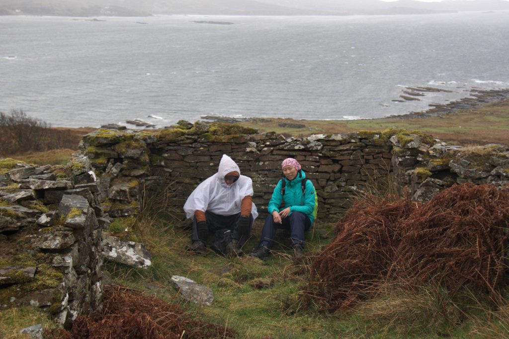
Amy and Dave shelter from the wind in the remains of one of the first of the Clearance Villages at Boreaig
Waterfalls boosted by the rain cascade over the craggy edges as we amble along the shoreline towards Carn Dearg. My footsteps bring me to an old Suisnish building sheltered by a line of deciduous trees, the rusty orange corrugated tin roof a contrast of colour against a bleak backdrop. The house was partially rebuilt in an attempt to restart crofting in the village in the early 20th century, but the current derelict state indicates that failed and remains a poignant reminder of the region’s sad history.
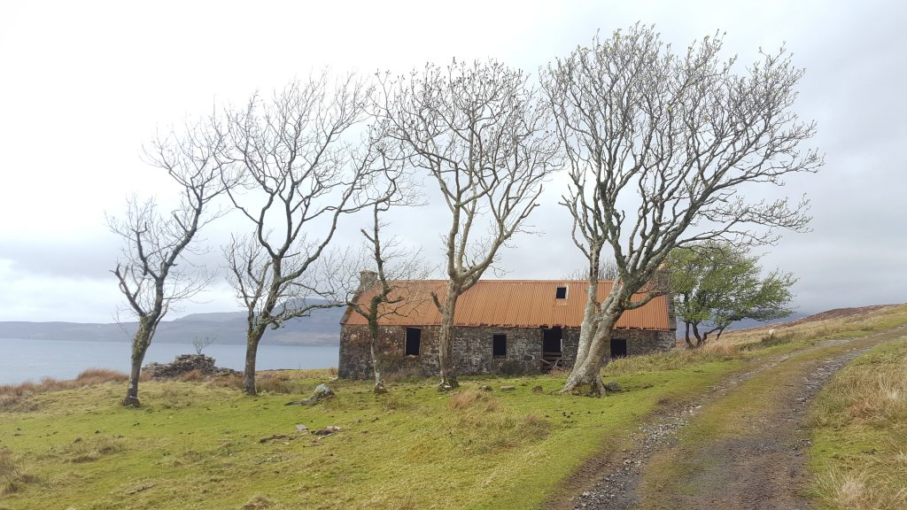
Suishnish house on the Clearance Walk Isle of Skye
The conditions remain wet and windy along the rugged coastline. Conversation is minimal. Each of us lost in our thoughts. As we amble onwards, the landscape transforms again to undulating dark brown hills swathed in evergreen heather shrubs. In a few months, these hills will morph into a carpet of purple and mauve. Ignoring the inclement weather, I find the landscape peaceful, the remoteness visually stunning.
By the time we reach the beach marking the end of the walk, we are ready to shed our rain jackets and muddy boots. The water has penetrated my inner layer (mental note: must purchase a ‘proper’ waterproof jacket.) Scottish weather has been relentless today and I’m looking forward to a warming whisky.
I now understand why the Scotts are partial to their whisky.
Summary of hike: The Clearance Villages Circuit
Mostly clear paths, tracks and minor roads, boggy in places.
Walk details: 14km, approx. 5- 6hrs
Day 7 – Glenelg returning to Inverness
We leave Skye crossing the Kyle Rhea straits on the MV Glenachullish, the last manually operated working turntable ferry in the world.
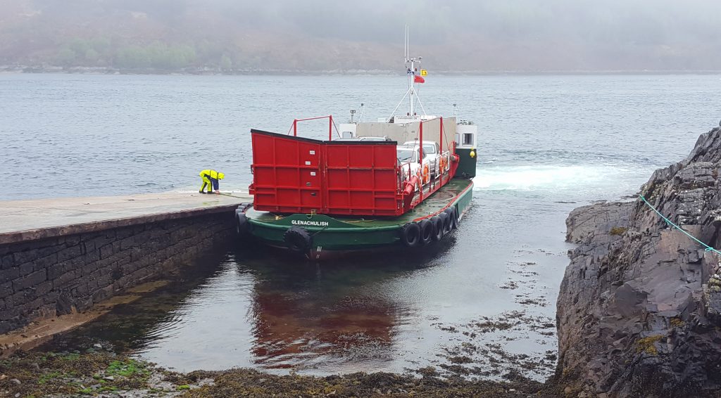
Glenelg Car Ferry Glenaculish
The 10-minute journey crossing the Kylerhea Straits is guaranteed to pique the interest of anyone intrigued by mechanical engineering. I’ve not seen the fellas in our group (Tom and Dave) so intrigued (and excited.) They practically leaped from the van to watch the ferry load the next lot of passengers.
Over at Sandaig, we take a short hike to the Gavin Maxwell Cottage. Overlooking the Sound of Sleat to Skye bay, encircled by trees this wild location was the home and inspiration for Maxwell’s memoir the ‘Ring of Bright Water’ about living with his pet otters. The book became so popular that his once quiet haven became overrun with curious visitors.
Now the isolated spot is the resting place for Gavin and his beloved otters.

Gavin Maxwell Cottage at Sandaig
Walk details: 3km, approx. 1.5 hrs
Near Glenelg in the valley of Gleann Beag with misty rain falling from the grey skies, we stroll through two of Scotland’s best-preserved Brochs: DunTroddan and Dun Telve. Jude says it’s unusual for brochs to be located so close (Dun Troddan is 500 metres further up the hill.)
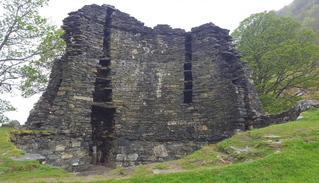
Dun telve broch near Glenelg
The black van heads east along the spectacular Mam Ratagan Pass. More stunning scenery to absorb from the comfort of the car, before arriving back at Inverness and the end of our Wilderness Scotland tour.
After seven days together, its a little melancholy saying farewell at Inverness train station. But all good things must come to an end. We’re returning to different places – new adventures.
Amy and I wait for a train to Edinburgh, where we play tourist for a few days (well I do, Amy tries to recover from her cough/cold) before we head off on our Iceland adventure.
Out of our group, I have since met up with Sue in Seattle (December 2018) enjoying a fabulous weekend with her discovering the unique and very quirky town of Leavenworth.
Our memories live on through photos and notes.
And two years later, during the quieter ‘stay at home’ times brought on by the Coronavirus, I’ve finally pulled this story and images together.
I hope my story inspires you to explore an island I fell in love with.

Our crew from left: Jen, Jocelyn, Tom, Margaret, Amy, Sue and Dave at the back. (Jude, our guide, took the pic.)
Other information:
(Where I stayed)
On the tour, I stayed at the following two hotels and recommend them as central locations, filled with character and both offering incredible vistas.
This hotel is in the north end of Skye in the village of Uig, the departure and arrival point for the ferry to the Outer Hebrides.
A refurbished hotel with stunning views to the mainland and the Knoydart Peninsula (Scotland’s most remote mainland.)
Leave a Reply